Day 6 - Petra, Wadi Rum, Aqaba, Israel border, Arava Highway, Dead Sea |
|
| 0:00 - 11:00 | Explore mountains of Petra Just an observation on claims of Aaron being buried here and Moses bringing forth water from the rock at Wadi Musa ... The Biblical narrative puts Mt. Hor further west across the Arabah in the southern Negev. And Edom -- where we now are -- denied the Israelites passage through its territory, forcing Moses east into the desert. |
| 13:00 | Picnic above Wadi Musa, Petra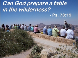 |
| 26:00 | The Kings Highway and the Desert Highway join |
| 27:40 | Descent at the Ras en-Naqb escarpment from the limestone Edomite plateau to the desert of the Wadi Hismeh and Wadi Rum, beyond, dominated by sandstone. To the west, the underlying granite rock is exposed. Along the escarpment where we are, a number of Edomite-era fortresses that dominated and protected the caravan trade routes have been excavated. |
| 32:00 | The Wadi Rum - the desert to the east side of the highway is the gateway to Saudi Arabia. This is Lawrence of Arabia country. |
| 43:45 - 53:00 | Begin long descent to the Arabah (Arava). This is a spectacular canyon. According to Sami, our guide, before the road was improved, this section of highway was know as the orphan-maker. |
| 54:45 - 62:30 | Sidetrip: Aqaba, Gulf of Aqaba
(Red Sea) and Eilat (Elath). Elath and close-by Ezion-geber were stops on the Exodus. The
site of Ezion-geber is not known with certainty but is tentatively identified with Tel
el-Kheleifi, about a half mile in from the shore. It is speculated that the predominant
north wind has extended the shore line southward by sand deposition since the Biblical
era. Solomon, in a joint venture with the king of Tyre, built a port at Ezion-geber to
exploit trade with southern Saudi Arabia, Africa and India. It was lost to the Edomites in
Ahaz's war with the Arameans. Recovered by King Uzziah, the attempt to revive the
enterprise by King Jehoshaphat and the House of Ahab failed.
|
| 63:50 | Border crossing into Israel at Eilat |
| 64:45 | The Arabah Highway. We'll be driving north through the Rift Valley (called the Arabah between here and the Dead Sea. The floor of the valley goes from sea level here at Eilat up to about 600 feet over the next 40 miles or so, then drops to 1,400 feet below sea level at the Dead Sea. To the right are the cliffs of Edom, to the left the Paran Desert (here in the south) and the Negev Desert as we approach the Dead Sea. |
| 71:30 - 78:35 | Sidetrip: Timna, site of "King Solomon's Mines." Copper mining has gone on here for millenia. A 1930s survey of Timna identified what appeared to be a walled-in section where workers were kept - perhaps the forced labor against which the Northern Kingdom rebelled. On the other hand, the identification of the mines with Solomon has been dismissed by many. Extensive copper mines have been identified on the east side of the Arabah as well. Perhaps these enterprises help explain the history of war between Israel (later Judah) and Edom. |
| 85:05 | Date orchard |
| 102:25 | The desert blooming like a rose. Greenhouses in the modern town of Paran. |
| 109:25 | More greenhouses, this time in the modern town of Tsofar. |
| 131:05 | Salt pans in southern bay of Dead Sea, extractive industry. |
| 133:40 | Mt. Sedom - Salt dome, runs about 5 miles along western side of Dead Sea. Spire formation known as "Lot's Wife." |
| 138:40 | Isrotel Hotel |